Hike to Santis, the highest peak from Appenzell
We've moved to Switzerland one year ago. We managed to visit Appenzell area three times in this whole year. The region is located in the NE part of the country and each time we visit it offers to us a special vibe. Switzerland has over 65.000km of hiking paths marked along the entire land. Each one of them gives the hiker the freedom of defining the exploration rythm.
What we know for sure about Switzerland is that it stands as one of the countries with the most diverse transport infrastructure toward all touristic points (funicular railway, train, cable, gondola). Due to this, the number of places where you can arrive on it wearing only a pair of jeans, a t-shirt, a jacket, and a ticket is quite narrow.
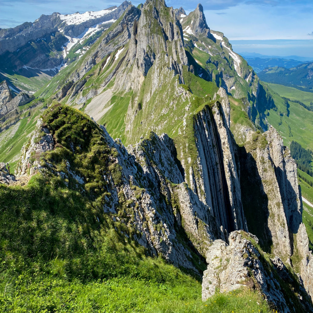
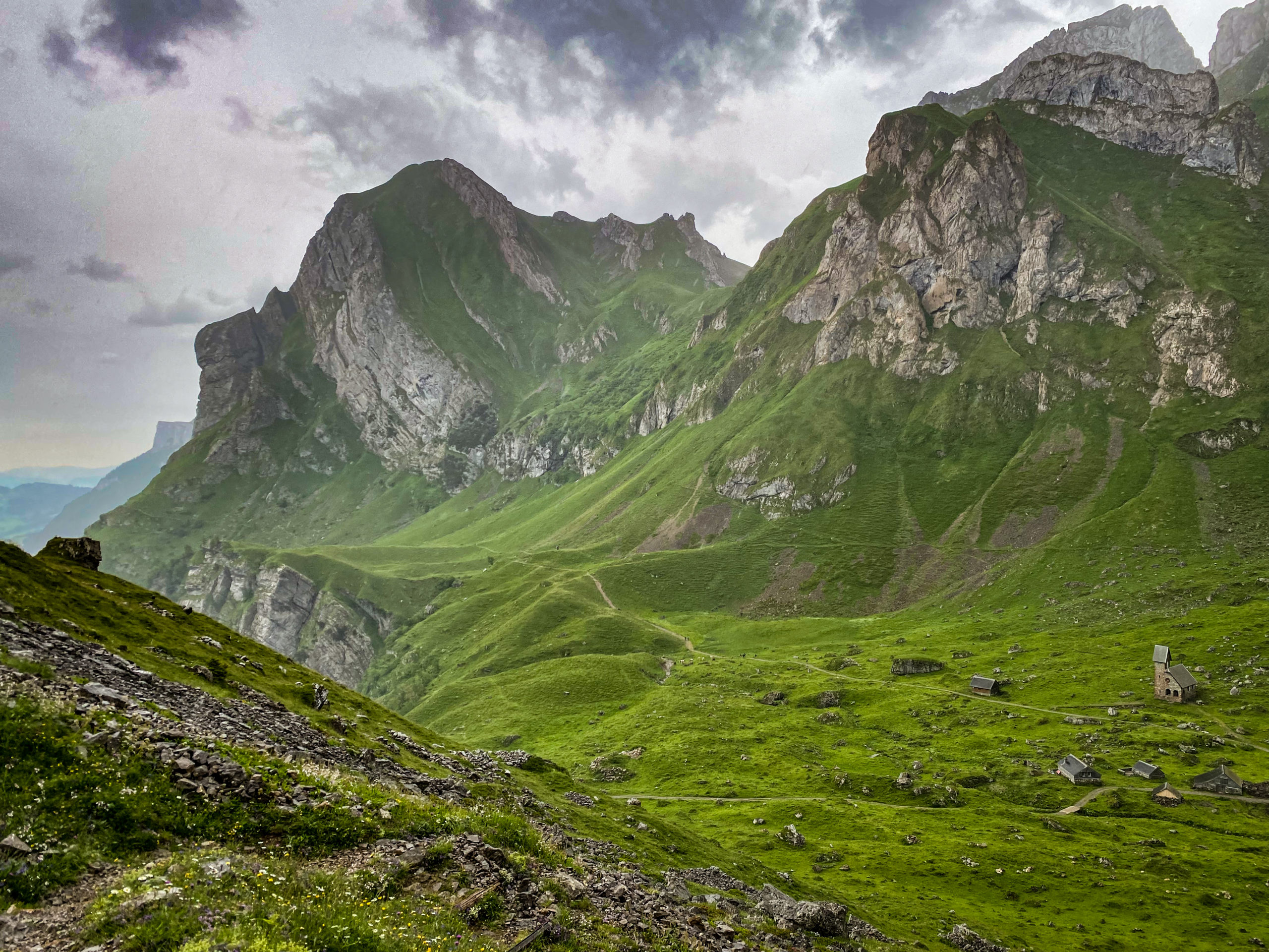
I am talking about this because, despite the accessibility of the Appenzell area, its beauty can be discovered mostly when you are getting lost on its paths. Aplstein, a subregion of the Alps from Appenzell area is composed of three lakes (Seealpsee, Fälensee, and Sämtisersee) and three regions with mountains (central, southern, and the northest part). Probably it's the most perfect area for hiking that attracts nature lovers and offers them authentic swiss mountain inns.
Hiking on Ebenalp – Schäfler – Säntis – Wasserauen
Overview: 23km distance, 1200m elevation, 1700m going down, 10h time, difficulty rate advanced
Link: https://www.strava.com/activities/5569546322
To discover its beauties, I would strongly advise doing at least one hiking path around the area. Here you can find alternatives for hike in Appenzell, Alpstein.
When to do this path?
I am writing this in the first days of June and was a perfect period to do it. I think it's a perfect time to enjoy a mix of sun (if the forecast will be on your side) with an intense green color of the grass, astonishing mountains and landscapes that will become a true point of reference for how other areas of Switzerland are looking. I although think from my opinion, that it's a doable path at least till October.
After this period it's really up to you how much you enjoy to embrace the snow. During the winter I am not quite sure if the path is accessible. You should check it up ahead if this is your plan.
Necessary hiking gear
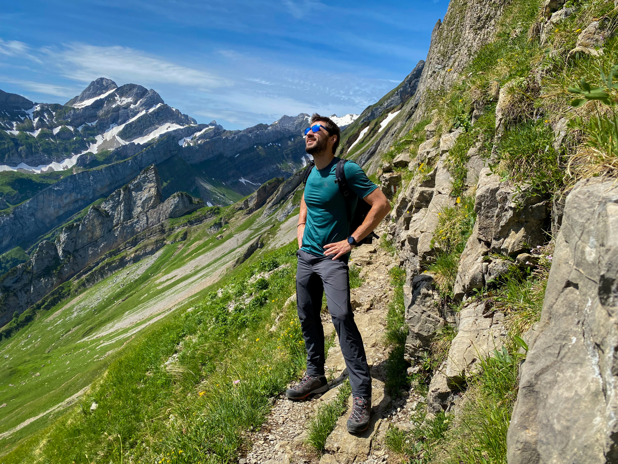
For this hike, I would strongly advise choosing some technical hiking equipment. Maybe a wind stopper and waterproof jacket, some hiking boots that you can rely on to not slip, and which offers you good support on rocky areas. Last, but not least... sun lotion. This if you don't want to pass through one experience I had on Jungfraujoch after which the mountain and the snow showed me the true power of one unhealthy tan.
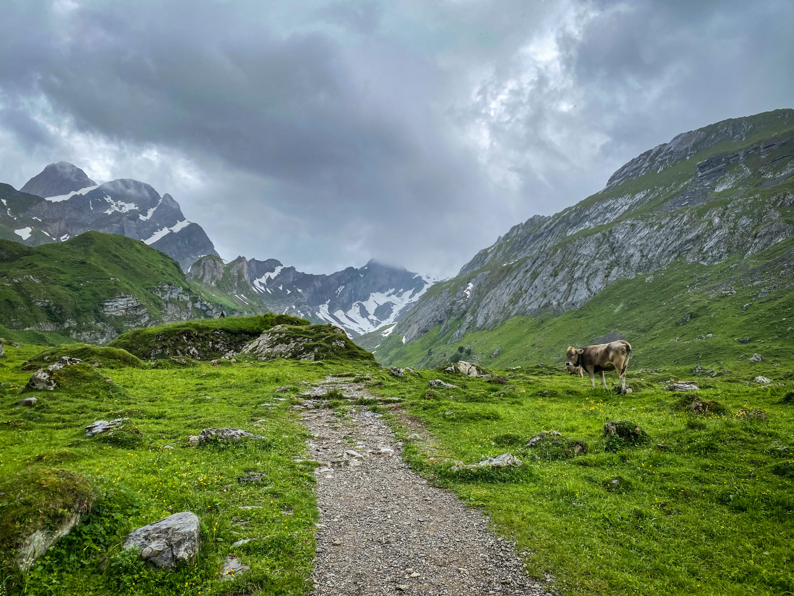
Besides this, in case that you are on the path when the sun goes down maybe to have with you, some lightning source would be a fit. The area doesn't offer too many concerns in terms of wildness, being the country where you are going to see the most often animals cows, dogs, horses, and sheep.
What I can say for granted is the behavior of the cows that are left free during the night. It's not usually a pattern, but you may encounter it. If they have as well babies, extra attention and distance from them is advised.
From where to start
The starting point of the hike path is located in the small village Wasserauen. To get here, you can jump onto a train and go down exactly near the place where you can start the hike. For this option, SBB is the official buying tickets platform for almost every middle of transportation from Switzerland with some small exceptions.
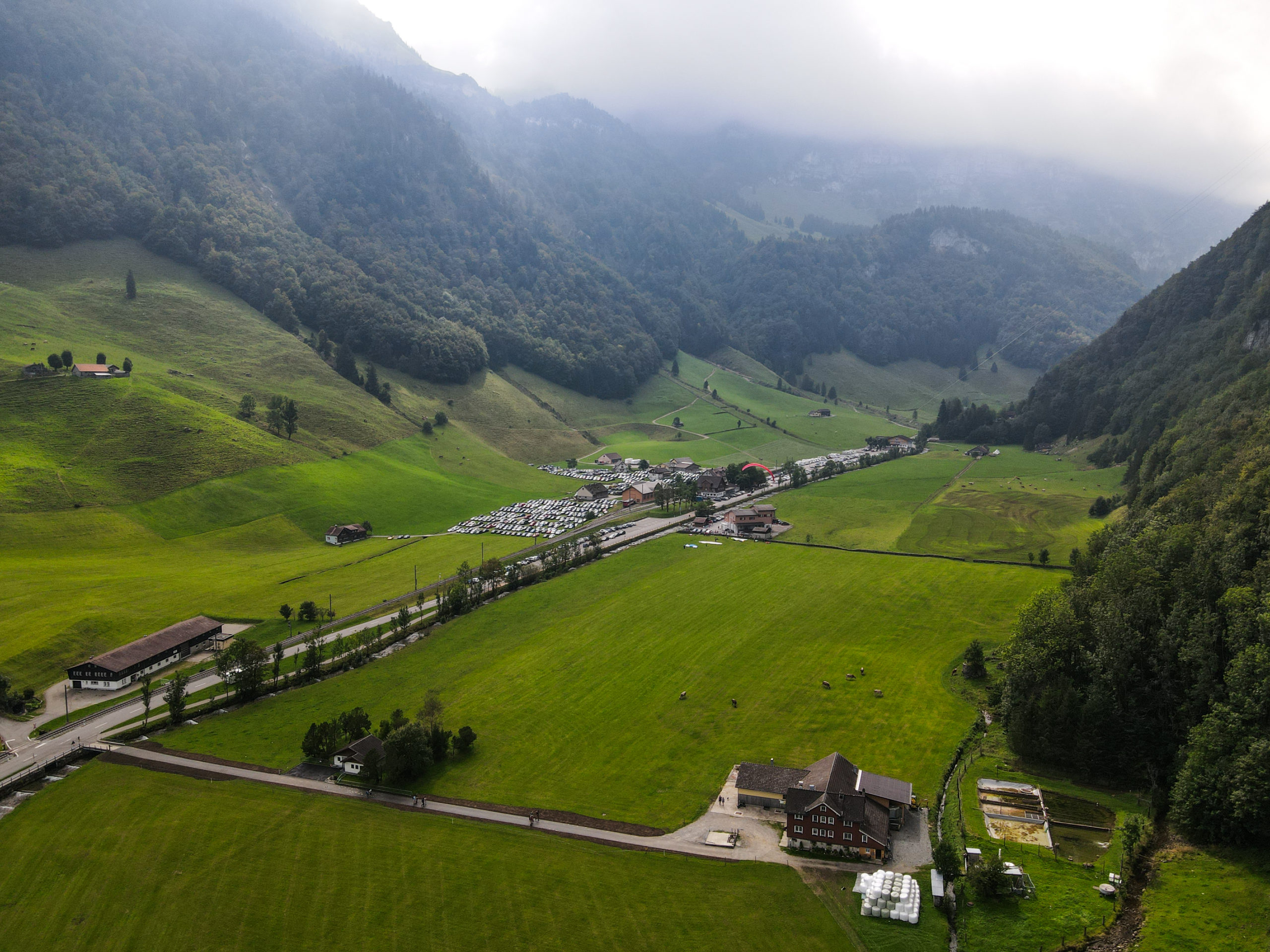
We've preferred the car since we're living here and it's more affordable for more than one person. It's a 1.5h ride. You don't need to worry about parking places, because you'll find some spots on Google Maps where to park. There, some guys will redirect you to the appropriate parking place. The cost of the parking is 3CHF per day.
We've started our hike from Ebenalp (1600m). This is the highest point of the right wall which stands on near Wassseerauen. You can pick up a cable car for it. It costs 22 CHF for a person without any deductions or discounts. one-way . If you want to choose Wasserauen - Ebenalp, you can do it as well, but the entire path till Santis is quite long and this segment will cover more than 2h. Wasserauen – Ebenalp voi detalia mai jos o alternativă.
The hike
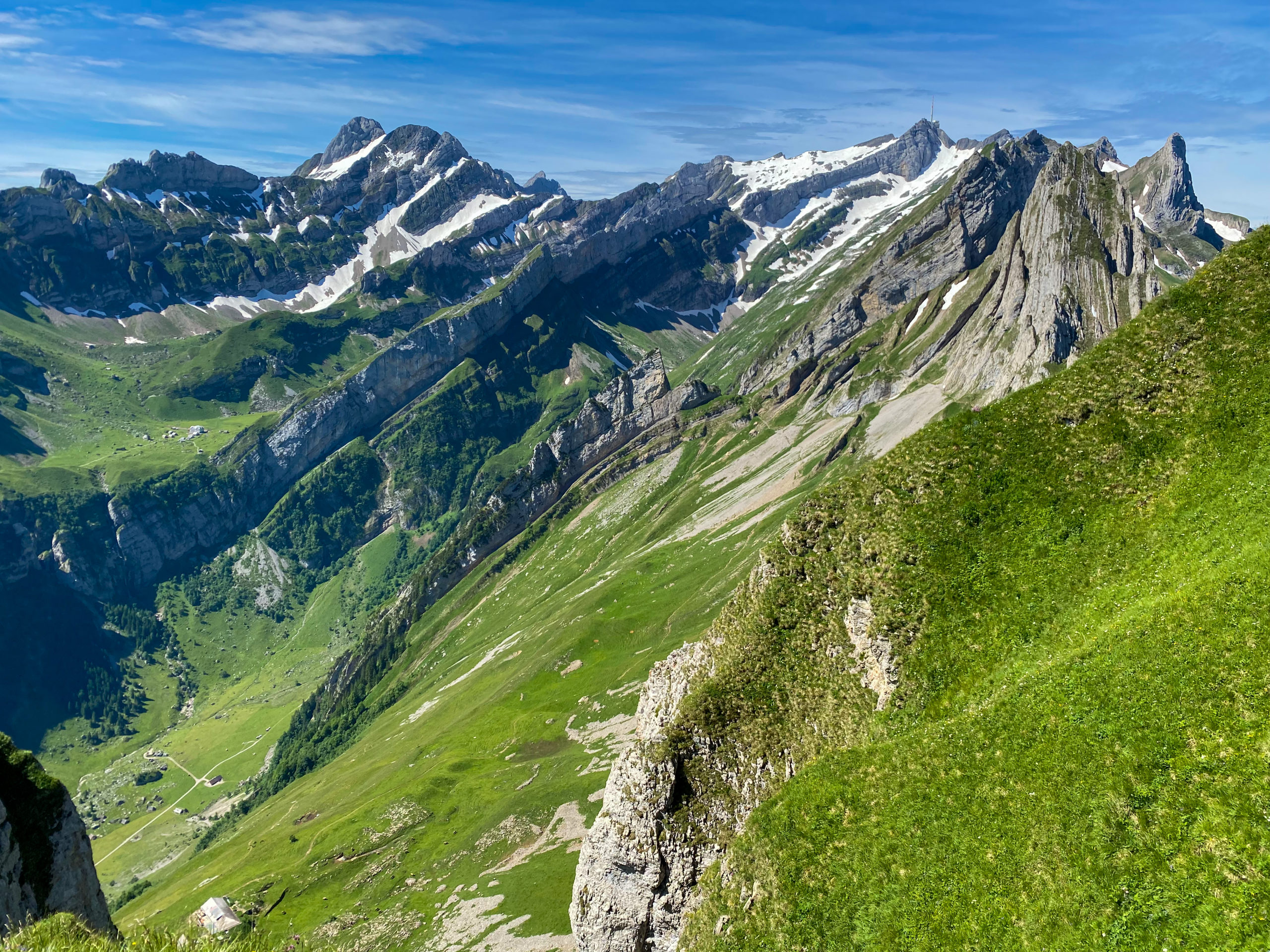
From Ebenalp the path goes with a small ascension. Around the 2nd kilometer the landscape start to blossom. On the left side, the Seealpsee lake will reflect the whole valley. On the right side, you're going to encounter a gorgeous view over the north side of Switzerland (from Konstantz till Saint Gallen).
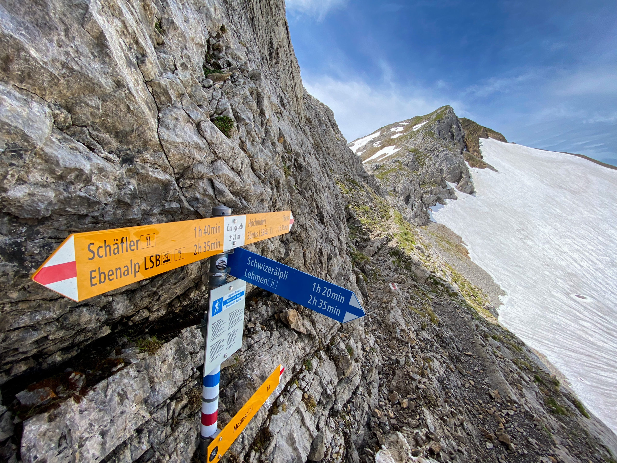
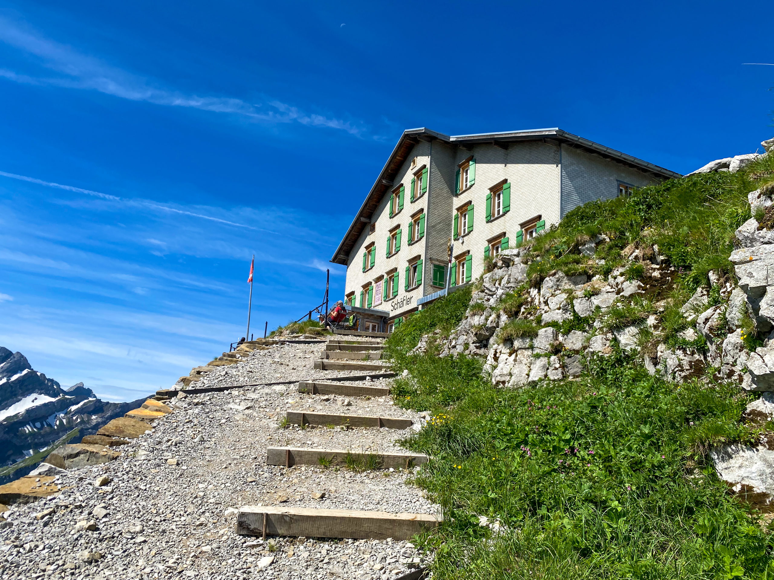
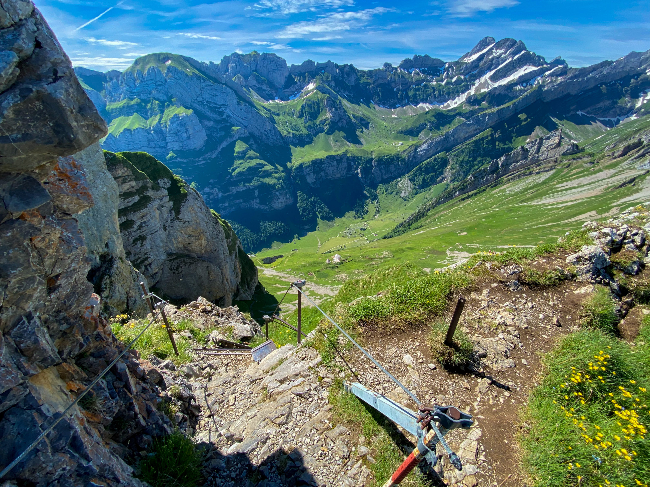
Up until Schäfler you're not going to make more than one hour. From here, the path start to be more challenging, offering some technical sections. The landscape will compensate, I can assure of that. The path will go along one cliff and around some areas you'll need to tackle it using the anchored chains. If you have ever been into Romania, this area looks similar to the Piatra Craiului Mountains from the Meridionals Carpatians.
The way up to Säntis
Until you reach the vicinity of Säntis peak, the trail will keep you at a similar pace and intensity. I would recommend undertaking this route in good weather conditions and ensuring that MeteoSwiss confirms the absence of rain. Why MeteoSwiss? Because it is the most reliable application when it comes to weather forecasts in this area. In the event of unfavorable conditions, at least be the kind of person who enjoys walking in the rain in the mountains.
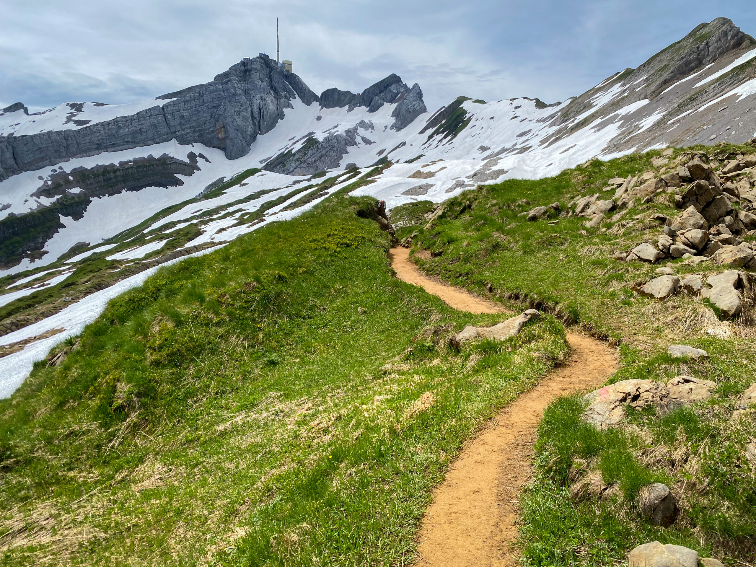
Immediately after the Altenalp Türm and Höch – Niederi Sattel the ascent to the Säntis peak platform will begin. There is a possibility that the trail may have sections covered in snow, and it's unlikely that you'll be able to follow the same path. When we hiked this route in July, we encountered this obstacle.
Taking a short break and a brief summary could indeed be quite helpful. We encountered a situation where two individuals ahead of us decided to deviate from the marked trail. Upon closer inspection, they were following a path already formed through the snow. Apparently, it was an alternative to the designated trail. I would suggest that when the trail is no longer visible, take a look around to see if there are already formed tracks in the nearby snow.
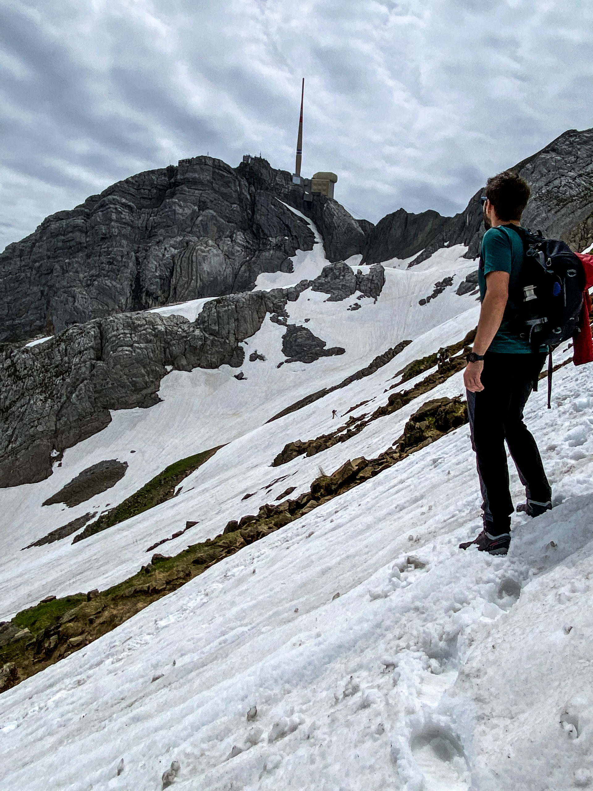
From here to the base of the ascent to Säntis, I would compare the path to kneading dough for a sweet bread. The snow will make it quite difficult to access. It significantly slowed us down. No matter how charged your batteries are, they will likely start blinking low here. Having high hiking boots would be a nuanced solution.
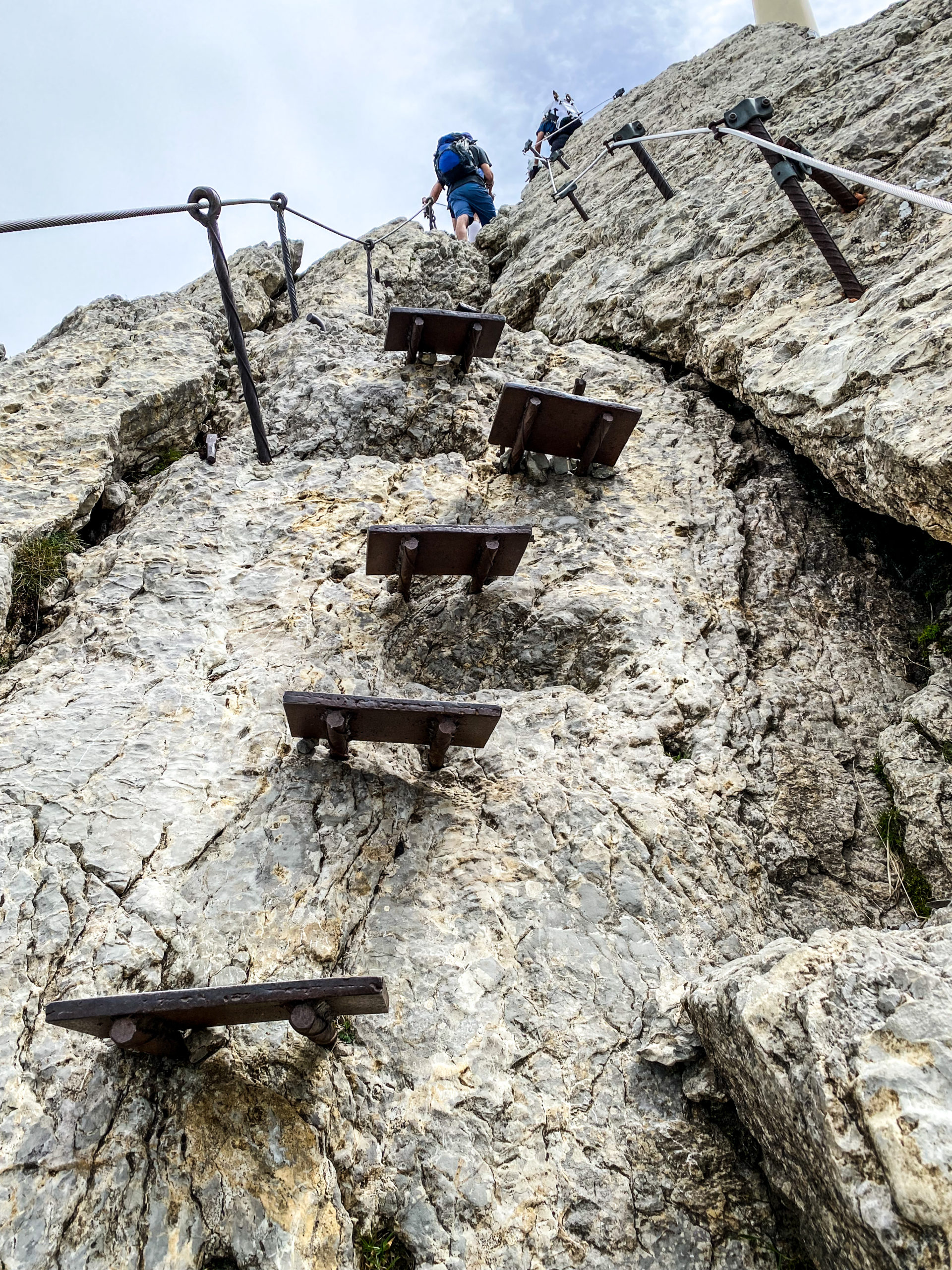
The final 200-meter ascent to Säntis is a serious and technical endeavor. It feels like being in a climbing gym. The difference is definitely made by the wide ledges and cables available at every step to hold onto. The incline can reach up to 90 degrees. If you have height-related issues, it may not be advisable to climb to the summit of Säntis, especially when carefully considering the last section.
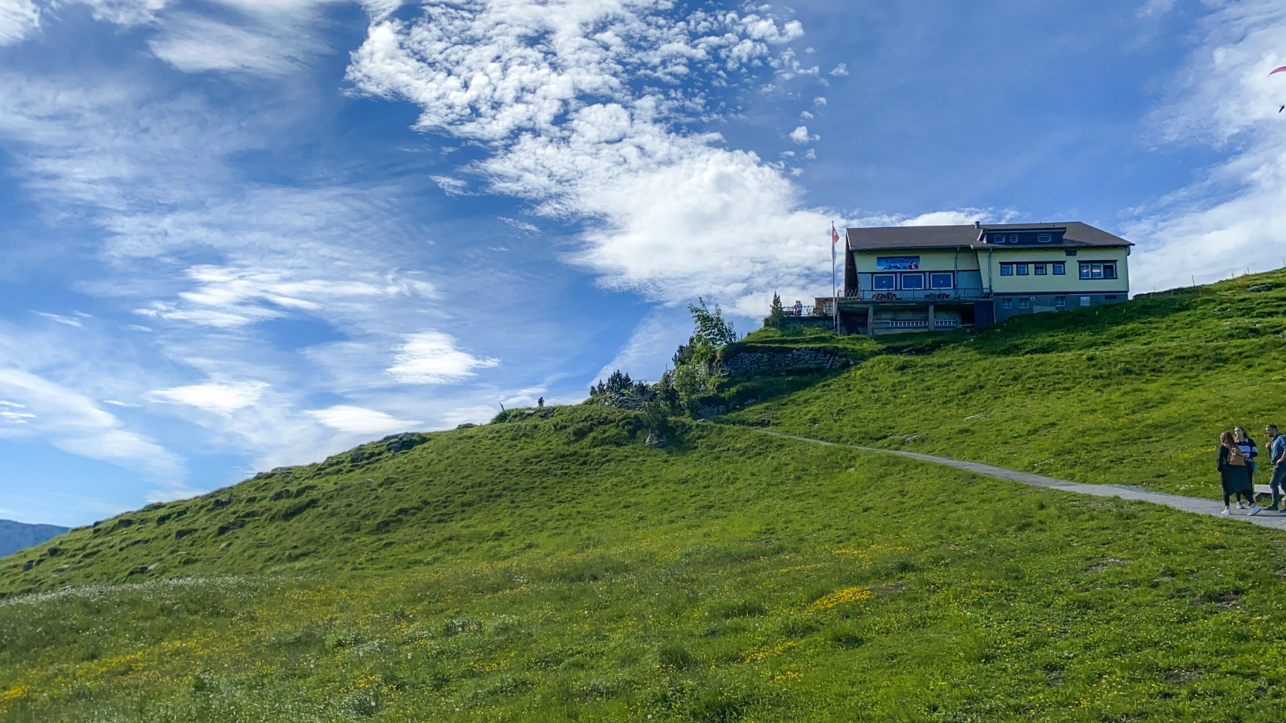
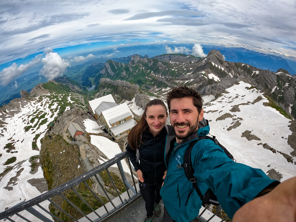
Säntis Peak (2501,9m)
The Säntis summit is a complex that includes terraces, restaurants, and accommodation facilities. I won't go into detail about these amenities, as you can find them in the article on MySwitzerland and on the website Säntis BahnA break at the summit is well-deserved, although the prices there are not exactly low. A beer starts at 7 CHF, a 1.5L bottle of water is priced at 7.5 CHF, and a Goba Cola costs 6 CHF (yes, Goba Cola, not Coca Cola... don't ask). The Bellevue terrace offers incredible views from various points on the rocky plateau. According to MySwitzerland.com, the panorama from Säntis encompasses six countries when observed in all directions from all viewpoints.
We regretted here the most of not having a pair of binoculars. If you have space in your backpack, especially if you reach Säntis by cable car (which many people do), I recommend either finding an observation spot with professional binoculars or borrowing a pair. Säntis is the perfect place to observe (with a bit of luck) the ibex and golden eagle. Unfortunately, we did not have much success in this regard.
Return to Wasserauen
From Säntis, you have the opportunity to continue on various trails. To return to Wasserauen, you have two options. From the terrace of the Säntis restaurant (the one with a more rustic appearance), a marked trail begins, indicating the way to Wasserauen. This trail leads directly down into the valley towards Lake Seealpsee.
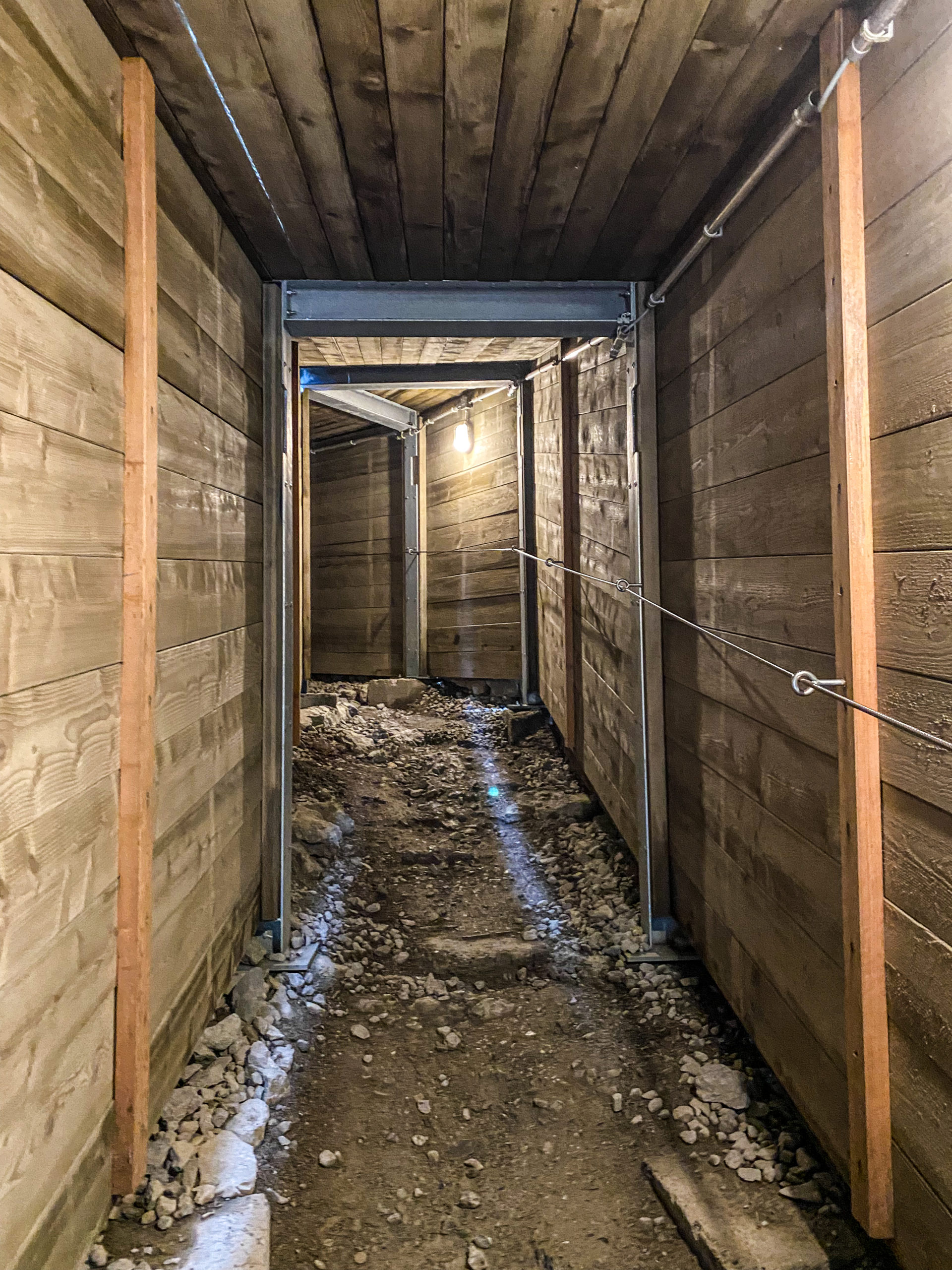
An alternative to that is the trail that bypasses the descent through Rotsteinpass. During the ascent to the Säntis peak, immediately after the technical climb, you will enter a tunnel. Inside the tunnel, you will come across a door on the right side that leads to the Säntis plateau. Continuing through the tunnel will take you towards Rotsteinpass and Unterwasser. This route provides an alternative way back to Wasserauen while avoiding the descent through Rotsteinpass.
From Säntis, three mountain ridges elegantly stretch out. The difference between the last two, which you haven't covered yet, is that the path from the restaurant directly to Wasserauen will pass along the middle ridge, while the one towards Rotsteinpass will continue along the other ridge. If this route catches your eye, you can find it here.
This was our initial hike. The approaching rain towards Säntis forced us to adjust our roadmap and shortened the time available for a stopover there. Another 10km of hiking was laying ahead of us.
Back to Wasserauen
The descent will take you through the same type of soft snow-covered terrain (if you're hiking in July) as you encountered on the ascent. If you're hiking in a different season, you'll need to be very careful. The rocky area can be slightly technical, but paying attention to where you step should be sufficient. The descent, in essence, is not as challenging. In fact, descending through the snow can be fast and fun. Yabadabadoo...
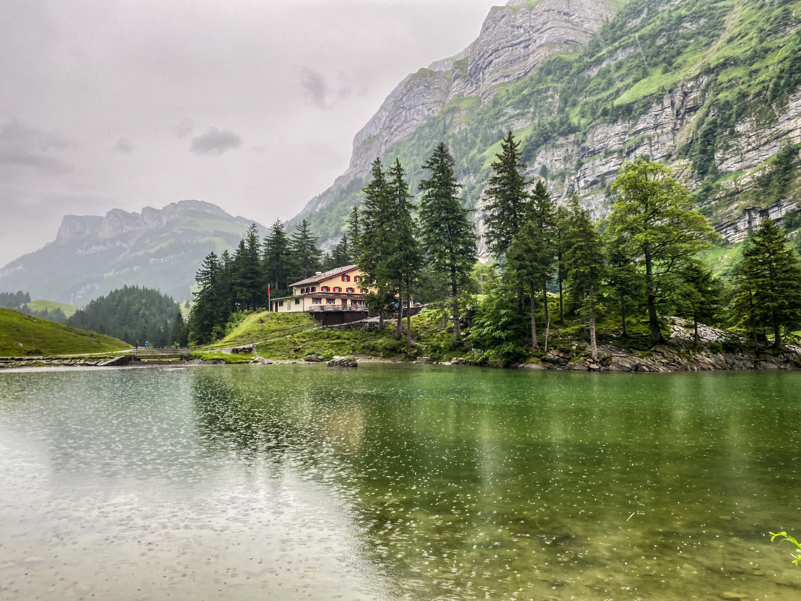
Fortunately or unfortunately (depending on the perspective), we were caught in rain three times during the descent. After the snowy section at the base of Säntis, you begin your descent towards Berggasthaus Meglisalpa rest stop between Säntis and Seealpsee. The area is magical, and the sound of cowbells adds authenticity and charm to the surroundings. Despite the rain, the picturesque scenery and the ambiance created by the cowbells make the experience truly special.
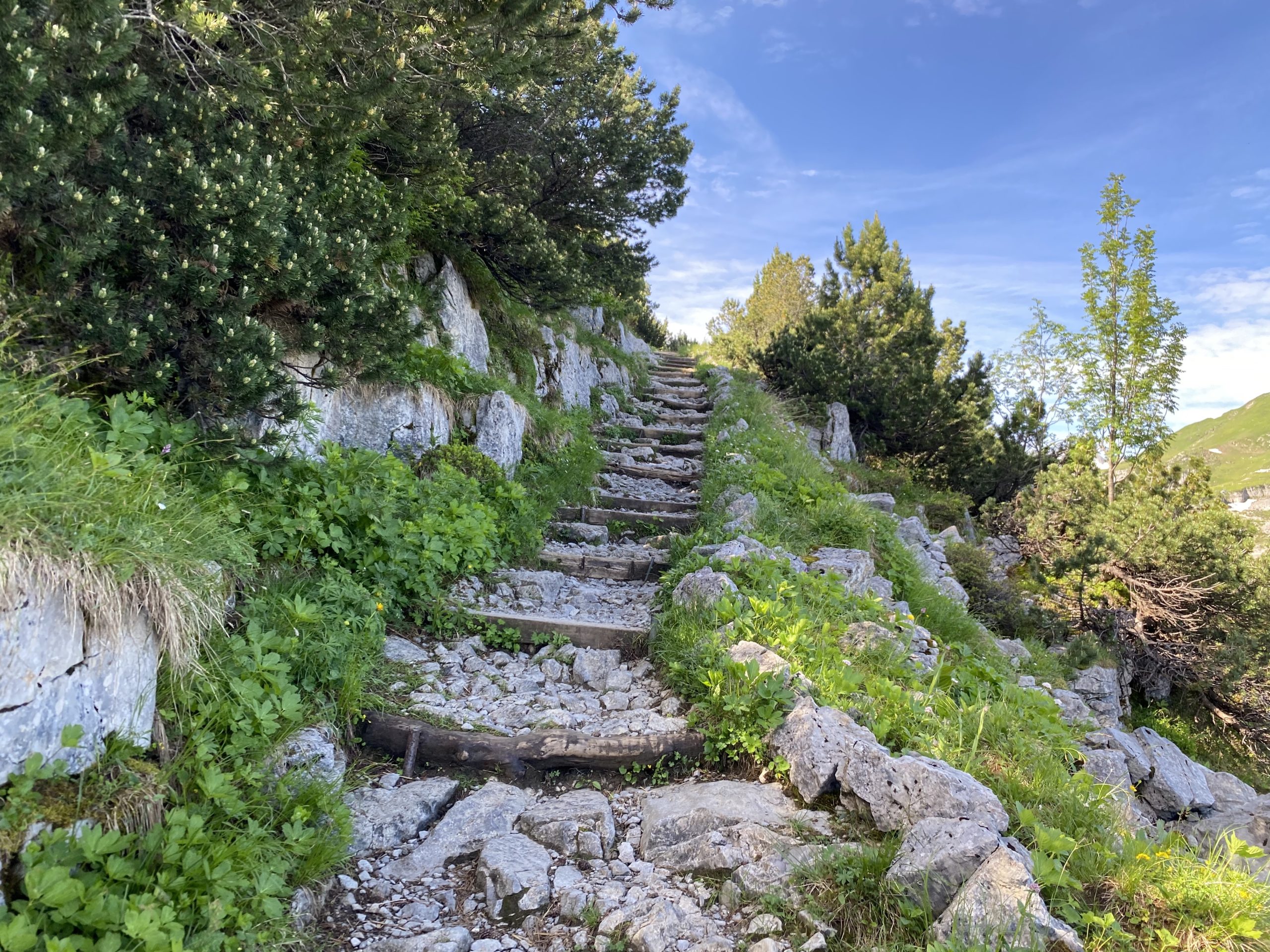
The trail continues with a descent from the plateau towards Lake Seealpsee. This descent involves a zig-zag path, consisting of stairs, rocks, and towards the end, you'll emerge from the forest and reach the edge of the lake. From there, it's just a 1-hour hike and a 200m descent on a fairly steep but accessible asphalt road to Wasserauen. We took our time and returned at a leisurely pace. We preferred to savor the experience like children, enjoying the gentle and warm summer rain.
On this trail, it is necessary to consider the overall weather conditions. It's important to assess how much time you have available, your physical strength, and most importantly, your relative fitness level. You don't need to be an athlete, but it's also not advisable to attempt this hike if you haven't done a 10km hike before. There is a risk of not fully enjoying the day in its true splendor, and it wouldn't make sense to do so. It's crucial to be prepared, both physically and mentally, to fully appreciate and make the most of the experience.
Other hikes that I would recommend
- Wasserauen – Aescher Wanderung – Ebenalp (12,65km, 784m elevation, average difficulty)
- Wasserauen – Ebenalp Ascher – Seealpsee (9km, 324m elevation, average difficulty)
- Ebenalp – Berggasthaus Mesmer – Seealpsee (14,5km, 724m elevation, average difficulty)
- Ebenalp – Säntis (8,5km, 1000m elevation, difficult)
- Brülisau – Sämtirsersee – Berggasthaus Bollenwees (Falensee) – Säxerlucke – Furgglenfirst – Sämtirsersee – Brülisau